HomeRobotic Database - Robotic platform | TERRINet
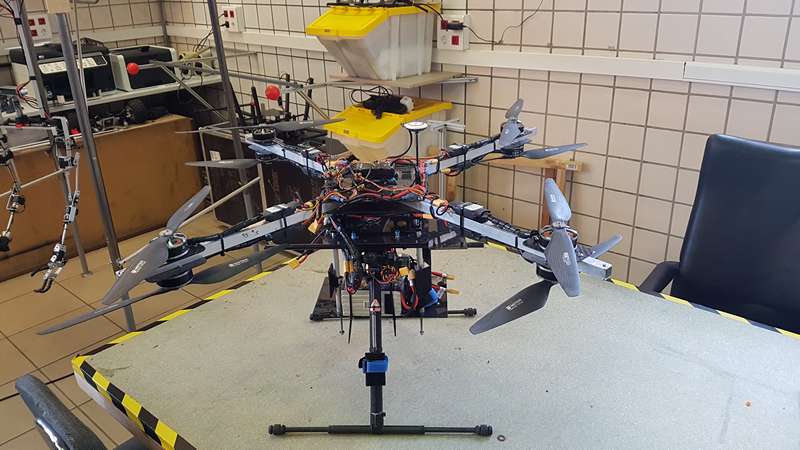
AMUSE
Self-designed octocopter controlled by a pixhawk autopilot with an Intel Nuc (I5) for extra computational capabilities. It also has a Jexton TX1 GPU and a velodyne 3D laser as extra payload. It is designed for accomplish different task, using different types of sensors, like stereo cameras, laser sensors, GPS, altimeters, etc.
Key features:
- Payload: 3D Lidar, Zed Camera, IMU, RTK GPS, Jetson Compute
- Speed: 2m/s Horizontal, 1m/s vertical
- Power Supply 6S LiPo
- MTOW: 14kg
- Endurance: 10 minutes
- Weight: 12kg
- Max speed: 4m/s Horizontal, 1.5m/s Vertical
Possible applications:
- Aerial recognition and data obtainment
- First person views flights and pilot training
- Structure inspection for maintenance works
- Tracing of objectives and surveillance
- Localization and mapping
Technical specifications
| Endurance: | 10 minutes |
| Average speed: | 2m/s Horizontal, 1m/s Vertical |
| Altitude: | 20 m |
| Power supply: | 6S LiPo |
| Interface: | Ros/Ubuntu |
| Weight: | 12kg |
| Autopilot: | Pixhawk (PX4) |
Access information
| Corresponding infrastructure | Universidad de Sevilla Robotics, Vision and Control Group |
| Location | Camino de los Descubrimientos, |
| Unit of access | Working day |
Access history
VILO - visual Lidar odometry based on monocular camera
Sherif A.S. Mohamed
•Implement a visual odometry module based on images capture by a single camera to avoid baseline problem in stereo cameras.
•Implement an algorithm to build depth-map based on input from LIDAR.
•Implement a tightly coupled-fusion algorithm to fuse the two modules to achieve more robustness and better accuracy.
I am working on a manuscript that expected to be publish to a conference paper about the results I’ve collected from this visit.
ESLAM - A lightweight and realtime SLAM for UAVs based on Event cameras
Sherif A.S. Mohamed
Extract data by mounting our DAVIS camera to the AMUSE platform and perform different routs and scenarios. We expect to work on the extracted data to complete one of our current work and publish the work on a peer-reviewed journal.


